Hiking A 14er....No Training Required?

.
When the mountains call you certainly do not ignore them and
boy did we answer in a big way. On my last Colorado trip my friend
Abigail and I decided we wanted to do something different. We wanted
to do something impressive, something that is maybe on everyone’s
Colorado bucket list and initially this meant we were going to hike the
popular Manitou Incline in Manitou Springs. Unfortunately, after looking
into this hike we found it was closed to the public due to, you guessed
it, COVID. We were definitely disappointed, but then that disappointment
gave way to determination and we decided we were going to do something
even more impressive than the Manitou Incline...we were going to hike to
the summit of Pikes Peak via The Crags trail. We turned our 4.5 mile hike
into 14.5 miles just like that a week before we set out. Are we crazy? Oh for sure.
But did we regret it? Not in slightest (well maybe we did during
the hike, but more on that later lol).
.
.

On the day of the big hike we woke up before the sun and were on
the road by 4:00am to make the drive from our airstream air BnB to The
Crags Trailhead in Divide, CO. We were both feeling surprisingly
energetic at this point, especially given the time of morning, but I think the
combination of the cold weather (it was barely 50 degrees out when we left) and
anxiety was definitely playing a huge role in this.
.
Official address of trailhead: 615 Teller Co Rd 62, Divide, CO 80814
.
Our Air BnB: https://www.airbnb.com/rooms/34676264
.
We loved staying here. The host is absolutely amazing, it is easy to find
and within driving distance of the adorable Idaho Springs, and it is in a
prime location right on the side of a mountain! Cell service is definitely
pretty shoddy, but you are in Colorado to get away and not be on your
phone! Also, with it being right on the side of a mountain you will get to
see a lot of wildlife. We were visited by the cutest little critters including
a fox and a mouse we named Fernando. (We had so much fun watching him.)

.
Everything was going smoothly. We were hyped up and ready to
tackle that mountain! However, not long into our drive our GPS did
us dirty. It brought us on this route of county roads full of tight curves
where the max speed limit was 35mph if we were lucky. It was the
perfect route to be driving when it is pitch black outside and you are
getting sleepier and sleepier the longer you sit in the car (NOT!), but Abigail
did an amazing job driving and 2.5 hours later we arrived at the trailhead.
.

.
Our goal was to get to the trailhead by 5:00am however, we ended
up getting to the trailhead at around 6:30am instead and the parking
lot was already almost full. We legit took one of the last spots so if you
plan on doing this hike I highly recommend you get there as early as
you can. It is clearly a very popular trail option. (Granted we were there
on a Saturday morning so you might have better luck on a weekday.)
.

.
When we started the hike the temperature outside was 42 degrees
and neither one of us had dressed for that kind of cold weather. (Layers are a great
thing to have when doing an all day hike. You never know what weather you might get!) In
light sweatshirts and leggings we marched our shivering butts to the
start of the trail wishing we had brought gloves and stocking hats and
hoping that hiking would warm us up quickly. We made a quick stop
at the bathroom (which I highly recommend since these are the only
bathrooms until you reach Devil's Playground) and then
began one of the best worst hikes of our lives.
.


(Start of trail!)
.

We laughed at this sign when we saw it at the start of the trailhead. Definitely were not
laughing about it when we reached the summit.
.


After almost 2 miles of hiking and an elevation gain of about 500
feet we took a quick break and ate a couple of protein bars. Up to
this point the trail had been pretty easy and we were starting to doubt
what we had read about this trail being a tough one. Little did we
know that we had made a critical mistake near the beginning of
this hike and things were not going to stay as easy as we thought.
.


(Abigail the hiking goddess)
.


(Me)
.
We hiked a little farther and then came to what appeared to be
the end of the trail. We stood above the trees looking out over the
land wondering where in the world we were because there was no
way this was the summit of Pikes Peak. Eventually we found a spot
with cell service and I looked up the map for the Pikes Peak trail and
of course, we were right. This was not the summit of Pikes Peak but
instead The Crags. We had taken the wrong trail and just hiked
4.5 miles (round-trip) out of the way. Upon realizing this mistake we
practically sprinted back to the place where we thought we had gone
astray and jumped on the right trail slightly disheartened and behind schedule.
.

Quick note for all you hikers out there! If you are wanting to reach
the summit of Pikes Peak follow the arrow for Devil’s Playground
not the arrow for Crags. (I will have to admit that while seeing the Crags was not on
our agenda for that day it was still a really beautiful trail and a great one for
families since it is not too strenuous of a hike. We saw a lot of
older people, people with dogs, and people with kids on this trail while we were hiking it.)
.
It wasn’t long after we started hiking on the Devil’s Playground trail
when we finally understood what everyone had been saying about
the trail being a tough and highly strenuous hike. Unlike the hike to
the Crags this one was a near vertical incline. Our legs were screaming
and our lungs were burning as we climbed and climbed, and then
climbed some more. However, the absolutely amazing views did
provide us with a slight distraction. (When hiking this trail please watch
where you are walking! There are a ton of huge rocks, tree roots, and
branches on this trail and the last thing you need is to roll an ankle. I also highly recommend
bringing a pair of walking sticks. I wish I had brought a pair especially on the way down
the mountain. Would have saved my legs and knees a little bit and maybe kept
me from falling the few time that I did. )
.


Note the plane flying in the photo and y'all it is not landing!
Shows just how high up we were at this point!
.


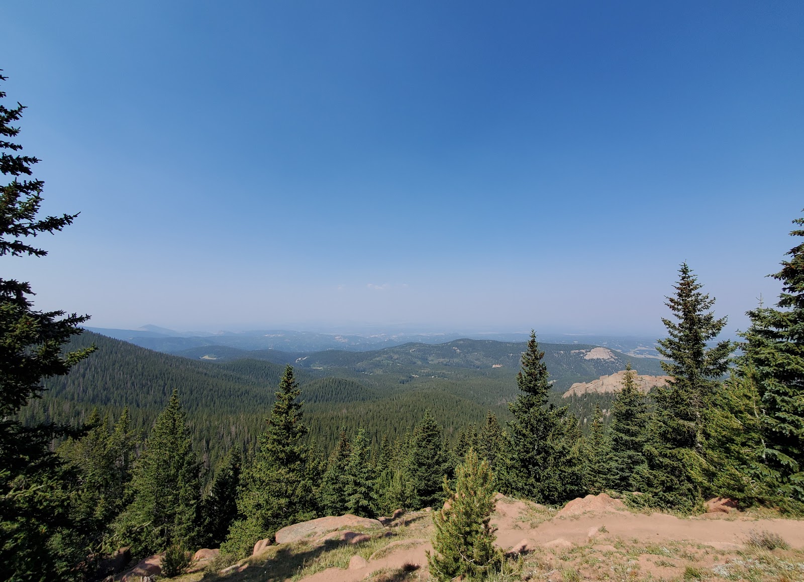
This photo is one you can take even if you drive
to the summit instead of hike it. It was taken at one of the pullouts right
after Devil's Playground. Just do be careful cause it is
a lonnnnng ways down if you fall! I had a lot of worried
mommas around when I walked out to the edge to take this picture! lol
.
We stopped to eat lunch right before reaching Devil’s Playground and
up until this point in our hike we pretty much had the trail all to ourselves
which was so nice. However, from Devil’s Playground on the trail was a
lot more populated so be prepared to share the trail and be courteous
to other hikers. I was also very surprised to see a lot of older people
hiking the trail to the summit from Devil’s Playground and we actually
had a lovely chat with a group of older gentlemen who gave us some
tips on tackling the rest of the trail (which was about to be the most
brutal part of the entire hike).
.


(Our lunch view. I could eat lunch here everyday.)
.
The final part of the hike involves a vertical (yes vertical) scramble through
a huge boulder field that sits on the side of the mountain. (There
are no safety nets or ropes to hold on to or catch you if you fall so
you have to be very careful where you step or else you will most likely
plummet off the side of the mountain to your death. So you know...no
pressure on your already weak and exhausted body! And there will most
likely be other hikers working their way through as well so be careful of them too.)
.
Then, as you are climbing your way slowly through this
boulder field, you think you can see the summit ahead. You push
and you push, so ready to make it to the top and when you reach
the spot you thought was the summit your hopes and dreams are
crushed as you realize that it is instead a false summit. To reach the
actual summit you have to either continue climbing up through the
boulder field or walk along the road to the top (which is what we
opted to do. Screw those boulders man. lol)
.
After we made it to the actual peak we were so happy. Finally the hike
was over! Well...for now. That happiness was short-lived when we
remembered that we still, after all of what we had already gone through, had
to go back down the mountain. The peak was only our halfway point.
Abigail desperately searched for Ubers to no avail and we almost accepted
a ride down the mountain with a group of motorcyclists we met at the
top. Suffice it to say we were feeling pretty desperate and were to the
point where we would have done anything to get down the mountain by
any other way than hiking regardless of the peril it
may put us in. However, after spending a little time at the
top re-grouping, we summoned up the tiny amount of strength
we had left and started our journey back down the side of the mountain.
(We were able to ride the free shuttle down to at least Devil’s Playground
which saved us some hiking and was absolutely incredible.)
.

This lovely sign sits right out front of the Summit House atop of
Pikes Peak. You will most likely have to wait in line to take
a photo with it because of course everyone wants a pic
with the sign, but we were certainly not about to pass up on this
photo op! We earned it dang it!
.
Also, at the top, as I mentioned, there is a gift shop and a small
food station where you can pick up the infamous Pikes Peak donuts.
We decided to forgo trying these donuts however due to
terrible cases of altitude sickness and pure exhaustion. We were lucky
to even be standing and food was the last thing on our
minds. lol (While we were there they were doing a lot of
construction on the summit putting in a new Summit House
complex so if you are planning a Pikes Peak
trip you might get to see the new building!)
.

(View from the top)
.
Once we unloaded at Devil's Playground we hiked as fast as we
could back down that mountain. Not only were we sooo
ready to be done with the hike, but we were starting
to see some lightning and the last place we wanted to be was
out in the open on the top of a mountain. Luckily, we were able
to avoid the lightning and the rain (it is always important to
keep an eye on the weather and start your hikes early as most
storms in the mountains happen in the afternoon). It took us a total
of about 8 hours to complete the 18 mile hike (this includes both
the length of the The Crags trail and the hike to the summit).
.

.
Honestly, we have never been happier to see Abigail's car Olivia in our
entire lives, but y’all we stinkin’ did it. We hiked a 14er without
training for it. Will we ever do it again? Ummmmm that is still
TBD. I hear the words “hike a mountain” and I feel like I have
some slight PTSD, but it was definitely an amazing experience and
I am so proud of us and happy that we can say "we did that...we climbed a mountain."
Definitely a peak achievement in my life. ;)
.
Some end of hike advice from two very exhausted hikers:
“If you are going to hike a mountain, train for it.” -Amy Makovec
“Have faith in yourself that you can do it and then just don’t.” -Abigail Svoboda
.
.
Have you ever hiked Pikes Peak or another mountain? What is your
proudest hiking achievement?
.
.
.