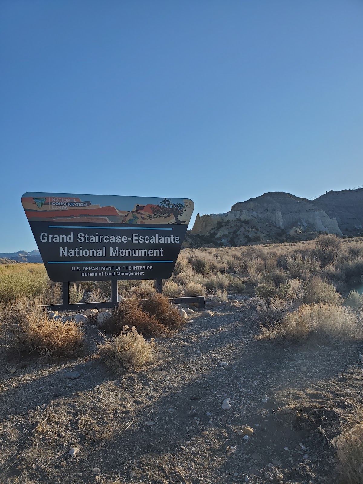
Squeezing Through Slot Canyons at Grand Staircase-Escalante National Monument

Most people when they think of hiking in Utah they think of Zion or
Arches. However, Grand Staircase-Escalante is one that seems to get
overlooked and I for the life of me cannot figure out why. Not only is this
national monument beautiful, but it provides a lot of diversity from
waterfalls to slot canyons that are definitely for people out looking for
an adventure. I really enjoyed my time in Grand Staircase-Escalante
and I know it will be a time I won’t ever forget.
.
.
.
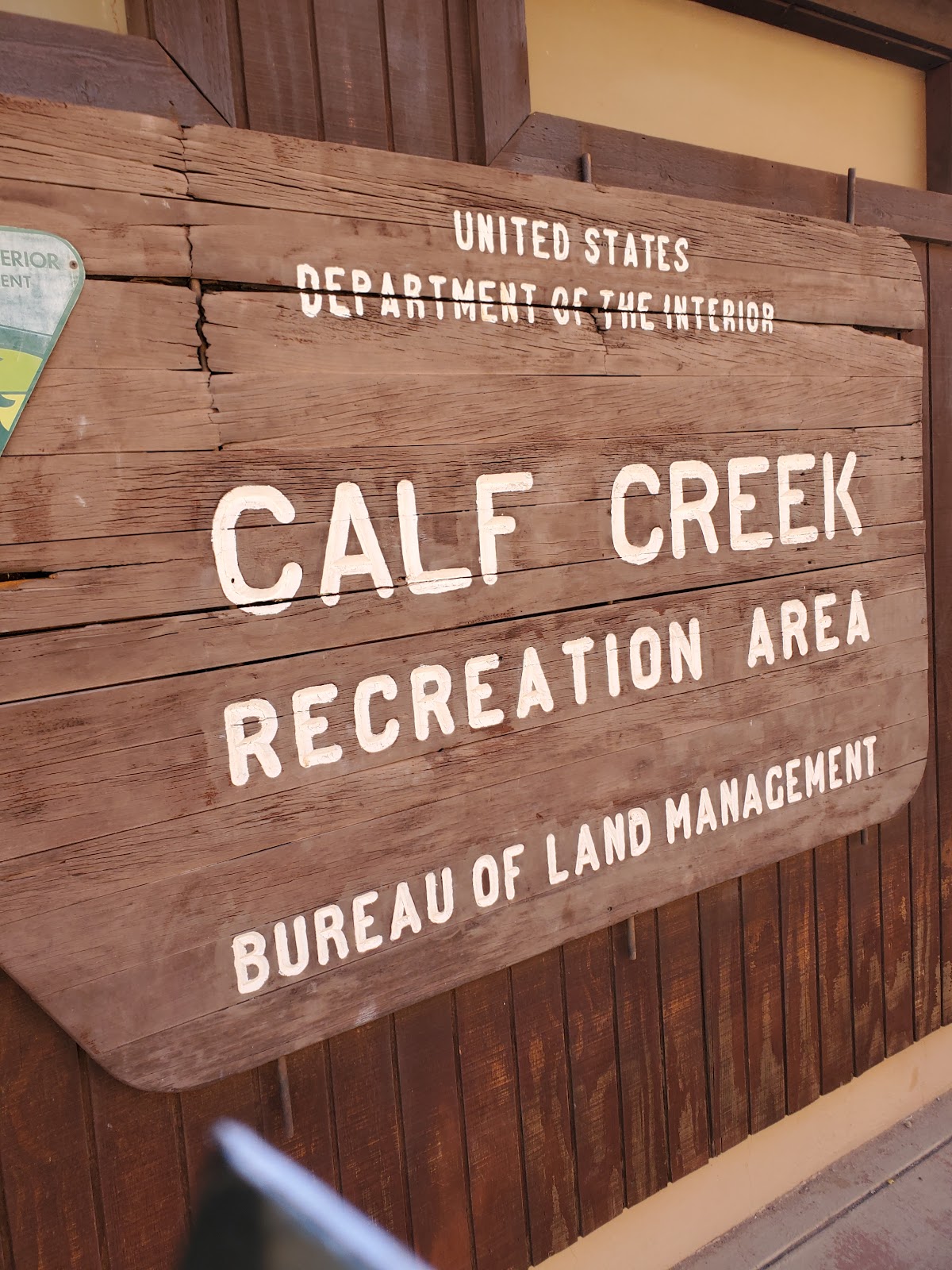
My first stop in Grand Staircase-Escalante was at the Calf Creek Recreation Area where I would
sign my life away and head off in search of the dazzling Lower Calf
Creek Falls. I got to the parking lot at around 9am on a Friday in April and
it was already starting to get pretty full. (By the time I left at lunchtime
it was PACKED. Like cars lined up along the road for half a mile packed
so I highly recommend you get here early.) You also will have to pay a
$5 day use fee and fill out a permit so be sure to bring cash for this!
(You can find the kiosk at the end of the parking lot towards the
trailhead for lower calf creek falls.)
.
.
After filling out my permit and placing it on the dashboard of the truck
I headed out onto the trail which starts about 300ft up the road
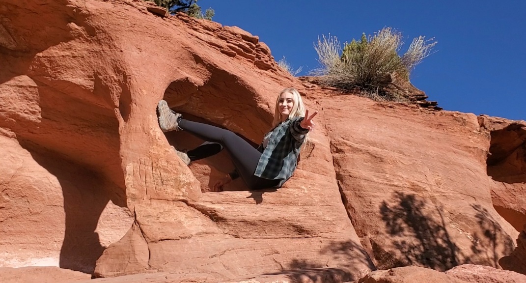
east of the parking lot. I signed the hiking register and then I was on my way to the falls! However, I didn’t even make it a half mile into my hike before I saw this cool cutout in the rock and decided I needed to take a picture in it. Typical tourist Amy. lol
.
.
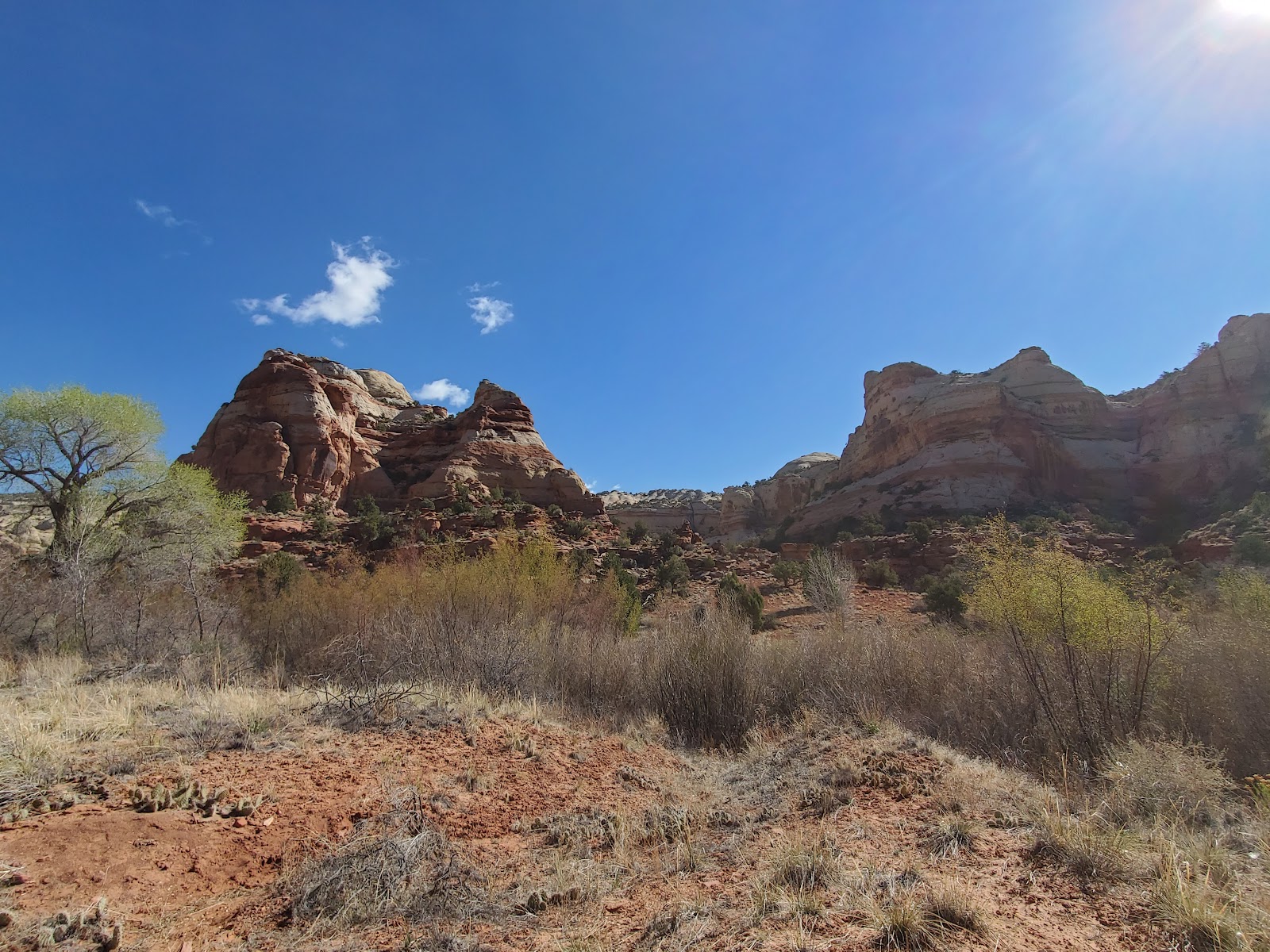
After my little photoshoot in the rock I continued on the trail. Overall
I have to say that the trail itself was very easy to follow with absolutely
gorgeous scenery. It wasn’t overly strenuous although there are some
areas with sand that just make the trek a little more difficult. You can
also bring your doggo along with you on this hike and I was actually joined
by these two beautiful dogs that belonged to another guy hiking on the
trail. They scared the crap out of me when they came running up behind
me because I had my headphones in and I didn’t hear them, but they
stuck around me and definitely made me feel a little more at ease on the
trail. (Maybe I need to start bringing my cats hiking with me. Hahaha)
.
Hiking to Lower Calf Creek Falls
.
Trail Name: Lower Calf Creek Falls
Length (Round Trip): 6.7 miles
Estimated Hike Time: 3-4 hours
Elevation: ~900ft
.

.
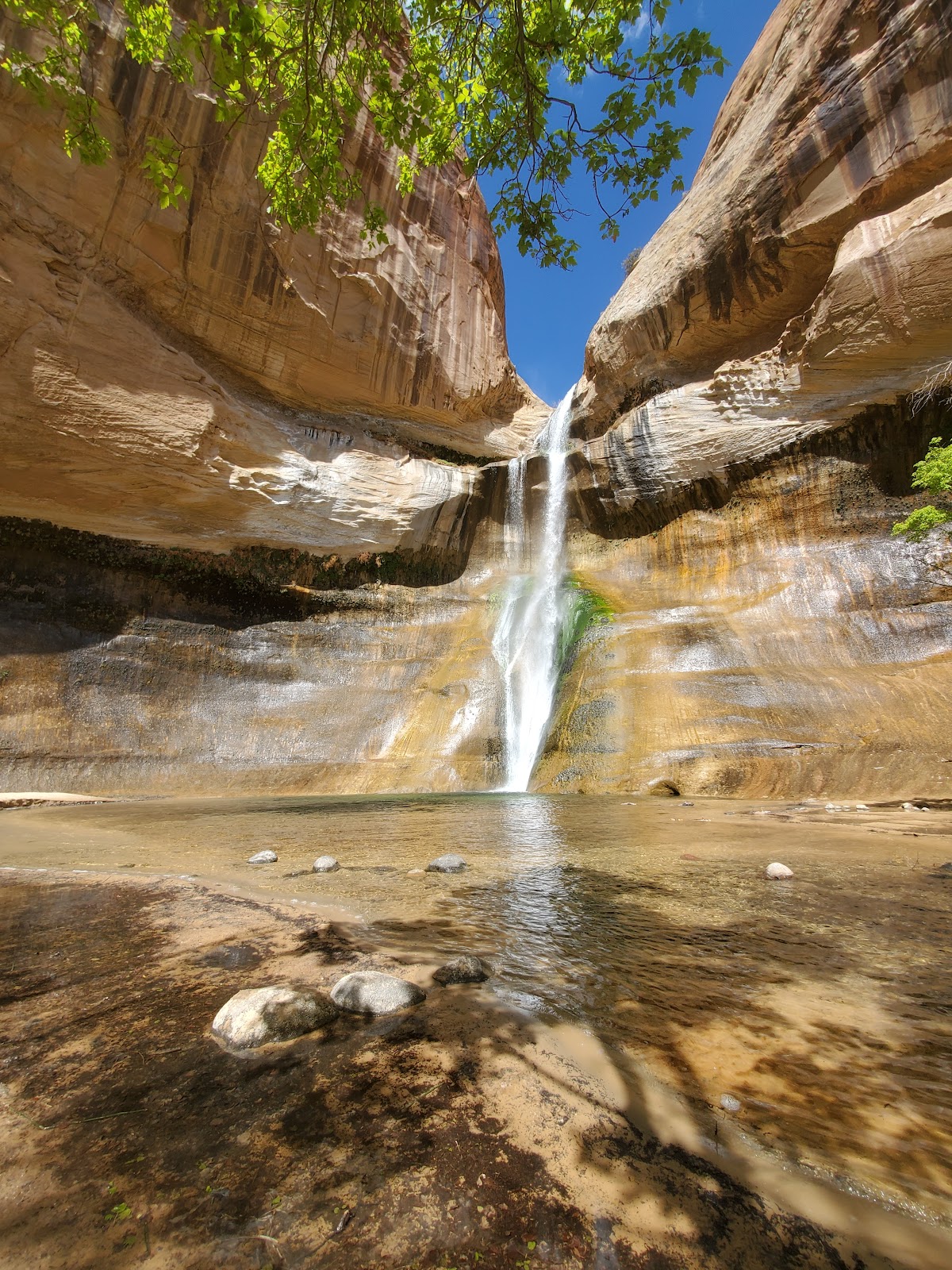
Hiking on this trail in the dead of summer is probably not going
to be the most fun, however, the waterfall at the end
definitely makes it all worth it.
.

https://videopress.com/v/7oAGAKT3?resizeToParent=true&cover=true&preloadContent=metadata
.
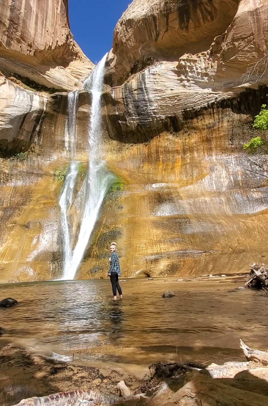
The water was FREEZING cold. Seriously my feet were numb
by the time I made it back to shore! Also the water does get
a lot deeper the closer you get to the waterfall, but I wasn’t about
to find out just how deep with it being so cold. Lol
.
Searching for Slot Canyons
.
After my hike out to the falls I was ready to go and conquer
my claustrophobia fears at Zebra Slot Canyon…if I could find it that
is. I managed to find a spot with cell service (which is a rare thing
out here so download as many of your directions as you can before
you come) and I put Zebra Slot Canyon into my phone.
.
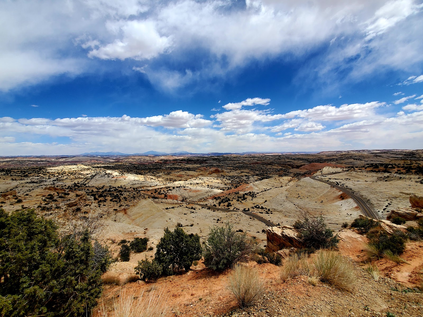
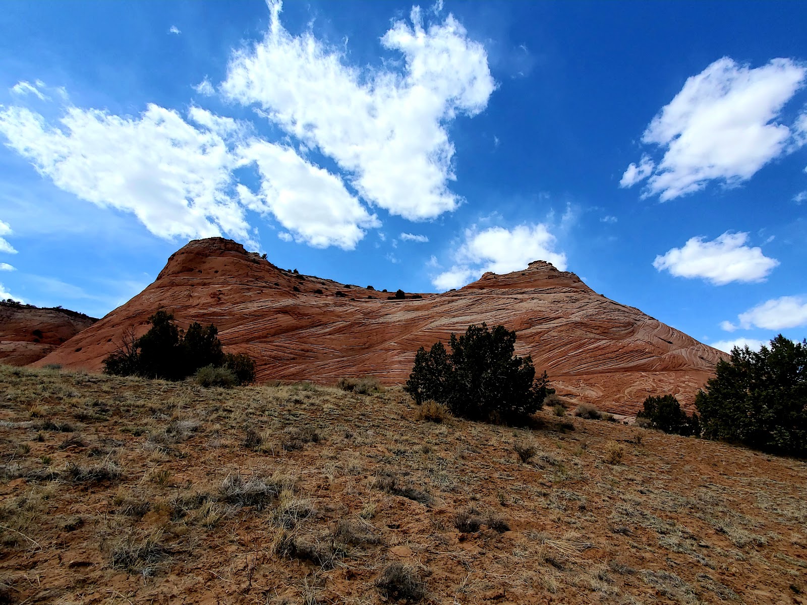
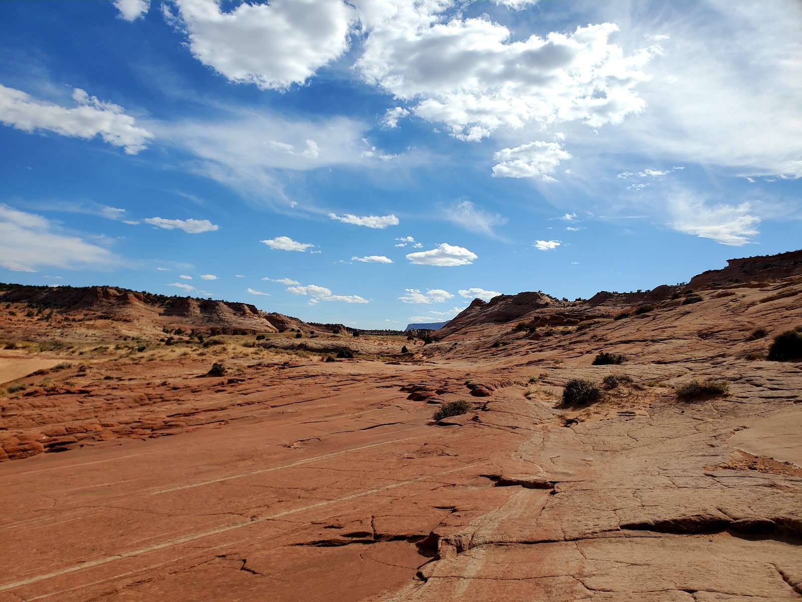
The views along the highway to Zebra Slot Canyon were just
breathtaking and I just had to stop at a pullout to snap some pics.
If you look close you can even see the blacktop road that runs
right through the rocky hills.
.
Eventually I made it to my turnoff and went down a road called
Hole in the Rock road which I think should have been called
Washboard Road From Hell instead. Seriously, that was one rough
road to drive on. Also, you can drive down this road in a car, but I HIGHLY
recommend you take a SUV or 4x4 instead. Let some air out of your
tires to avoid a blowout because y’all are in for quite the treat and if it has
rained recently don’t even try. You WILL get stuck no matter what
vehicle you are driving.
.
https://videopress.com/v/3WpMp7bR?resizeToParent=true&cover=true&preloadContent=metadata
.
I followed my GPS thinking since Zebra Slot showed up on the map that
it actually knew where it was taking me, but y’all Google couldn’t have
been more wrong. I ended up following this literal cow trail through a pasture
.

.
and then found myself sitting on top of this huge hill looking down on someone’s
campsite. Awkward! Oh and you know what my GPS was telling me to do?
Continue on the road…the road that wasn’t even there! I was sitting on a hill that
looked very much like Pride Rock from the Lion King and good ole Siri was
telling me to just drive right off the edge. Like jeez girl what did I ever do to you?!
.
So now it was decision time. Pride Rock was just barely wider than my
truck with steep sides and nowhere to turn around so at that point I was left with two
options. I could either back the truck up off the hill and into the pasture
or barrel down the side of the hill and then right back up without hopefully
rolling the truck. I was not really feeling either option to be honest, however, unlike
Tow Mater from Cars, I am not the world’s best backup driver sooo I chose option
two. (Probably the more difficult of the options I will admit, but I guess I wanted to see
my demise happen in front of me rather than be surprised by it when backing up. lol)
.
I threw the truck into 4WD and descended down the hill at a very sketchy angle, turned
around at the base, and then gave her hell to get back up the side of the hill and
back out into the pasture. I really didn’t think I was going to make it, but good ole Black
Beauty is quite the truck.
.
I drove through the pasture once again back out to Washboard Road From Hell
and began using the information I found in a blog article instead of my GPS to find
the trailhead. I guess my dad is right that you can’t always trust your GPS because
I found the trail easy peezy once I stopped listening to Siri with her murderous tendencies.
.
So here’s how I found it: Coming from the direction of Escalante you will turn
down Hole in the Rock road and drive on it for almost 8 miles (you can reset your
odometer when you start on the road to help you keep track of the miles). Along the
way you will come across cattle guards in the road and it is at the 3rd one that
you will find the trailhead parking lot off to the right usually evidenced by the cars
that are parked there.
.
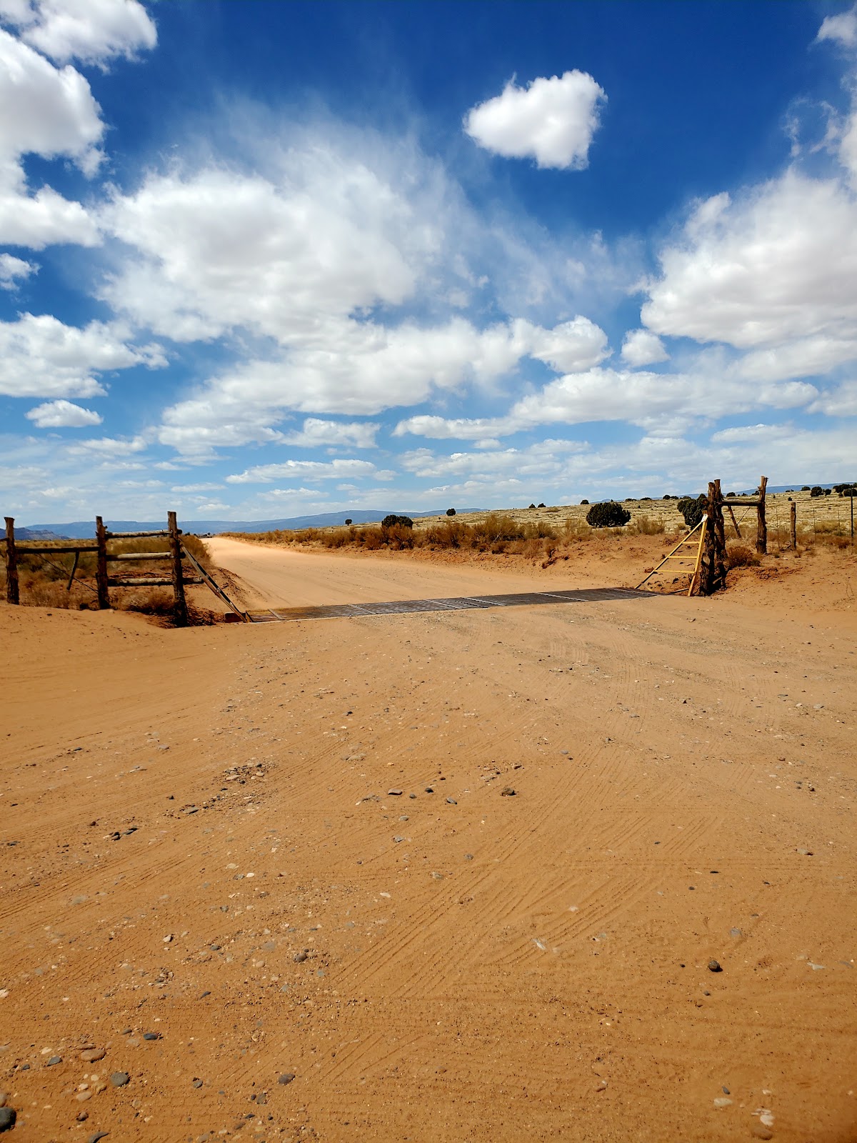
3rd Cattle guard. Image taken from the trailhead parking lot.
.
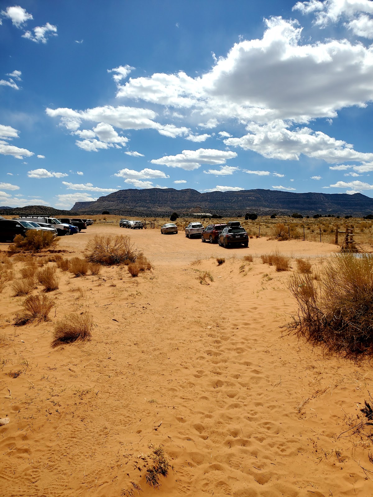
Another shot of the parking lot from the trail which is located right across the road from the parking lot.
.
Hiking to Zebra Slot Canyon
.
Trail Name: Zebra Slot Canyon
Length (Round Trip): 5.2 miles
Estimated Hike Time: 2-3 hours
Elevation: ~400ft
.
.
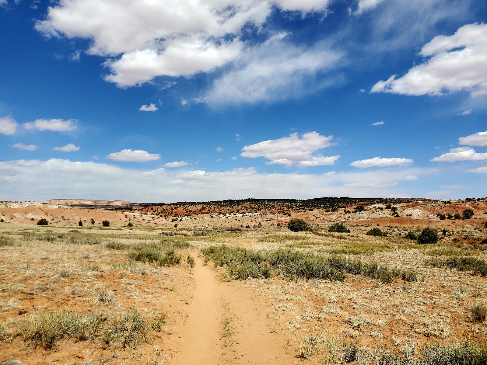
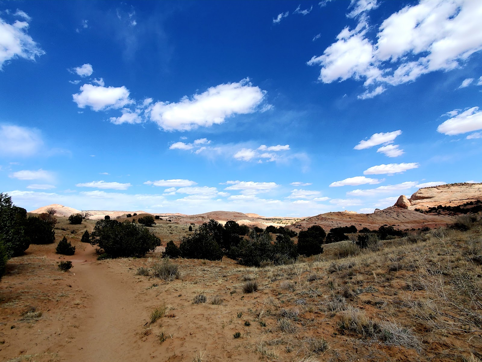
The trail itself I found pretty easy to follow and eventually you will find
yourself walking up to a gate. Just give it a little push and continue on ahead.
.
.
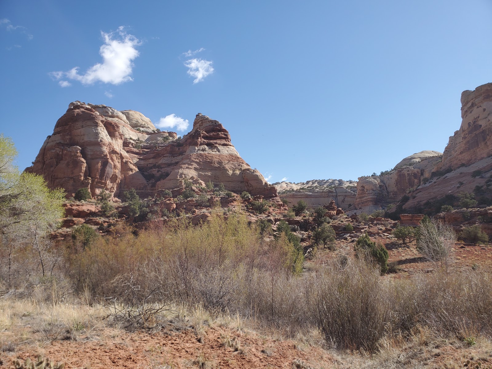
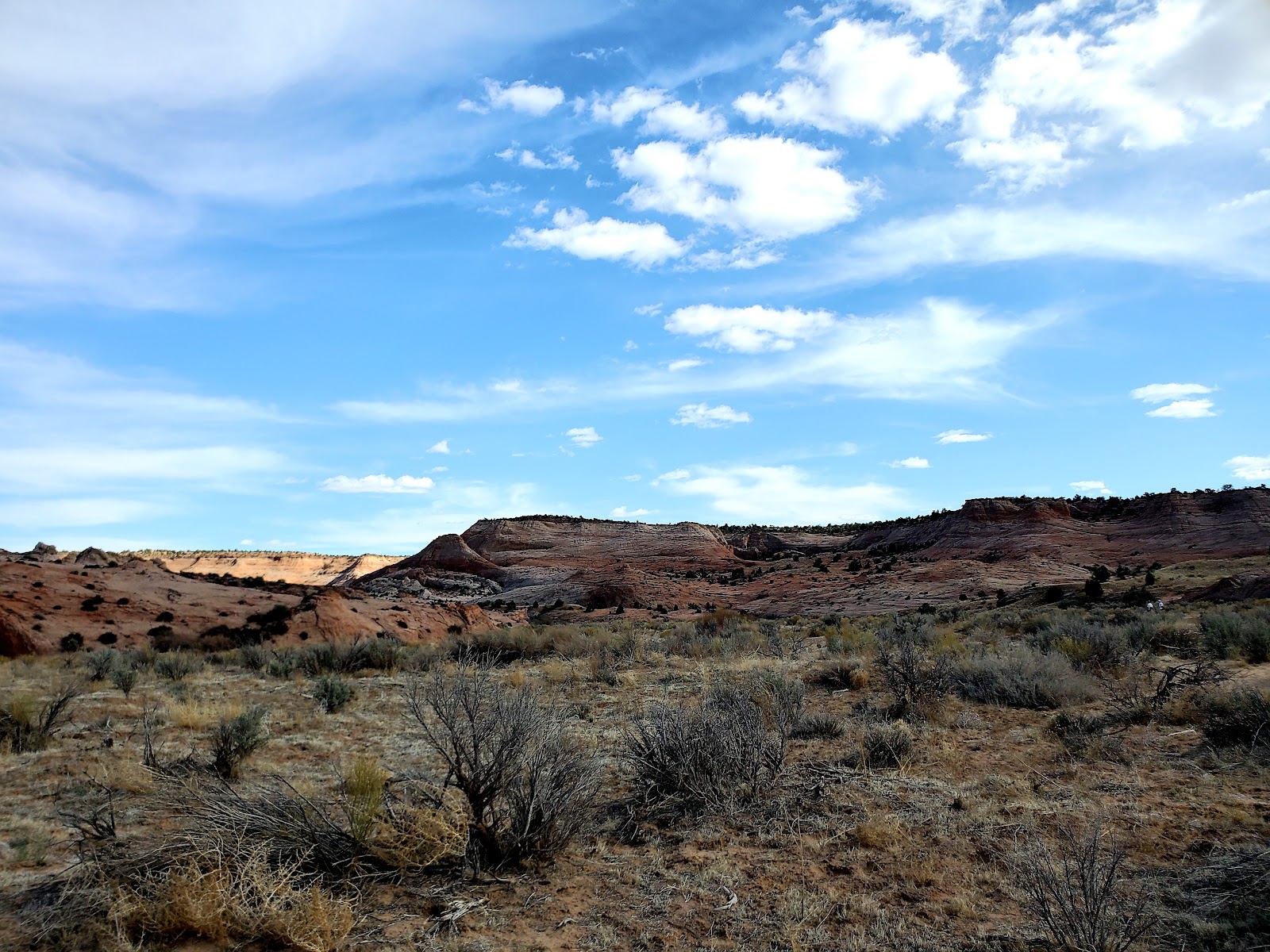
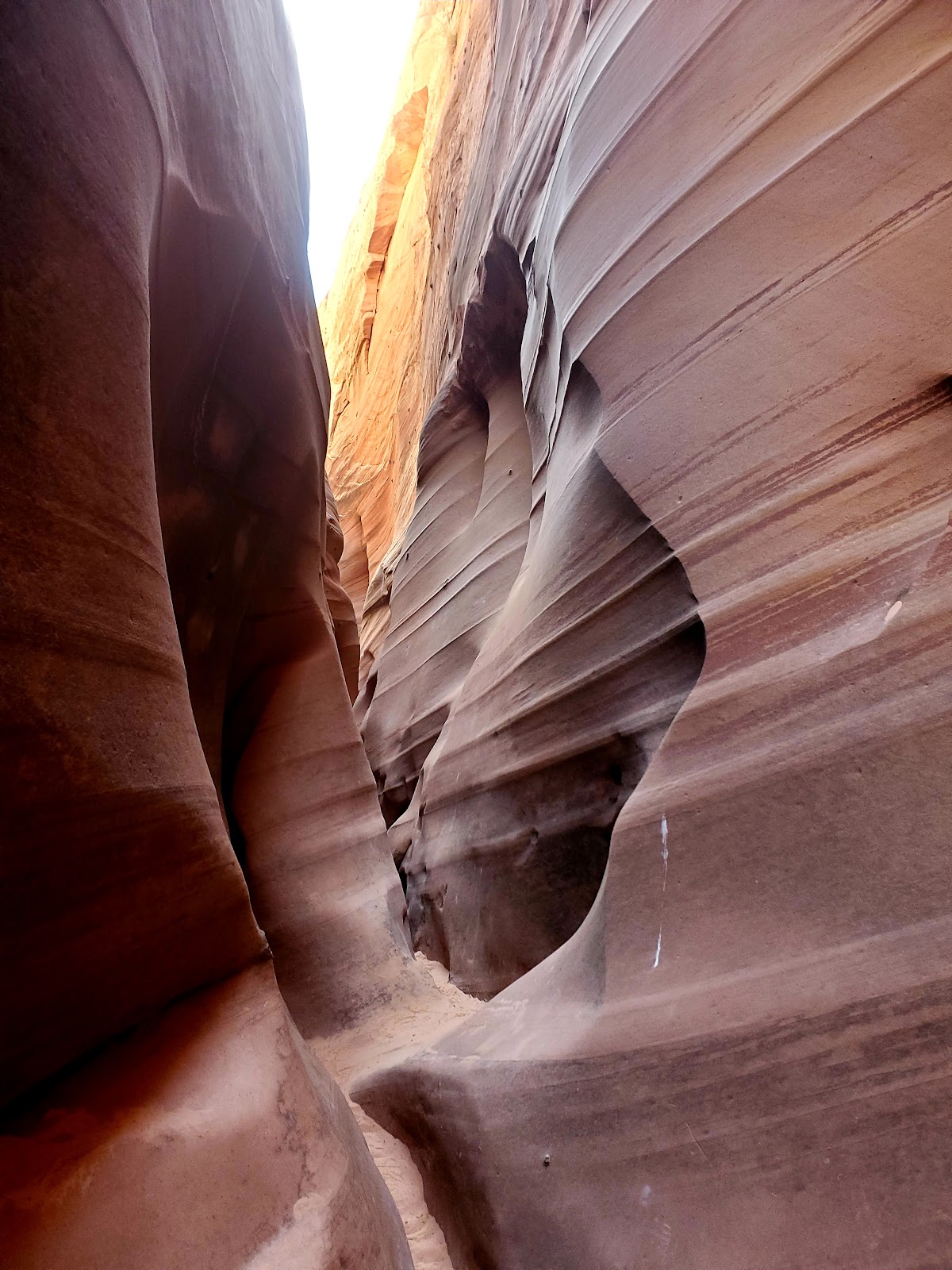
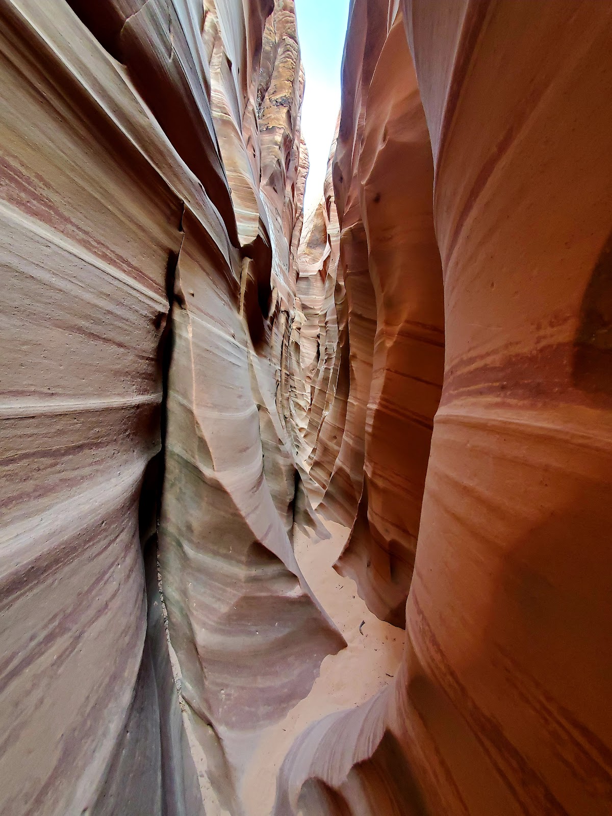
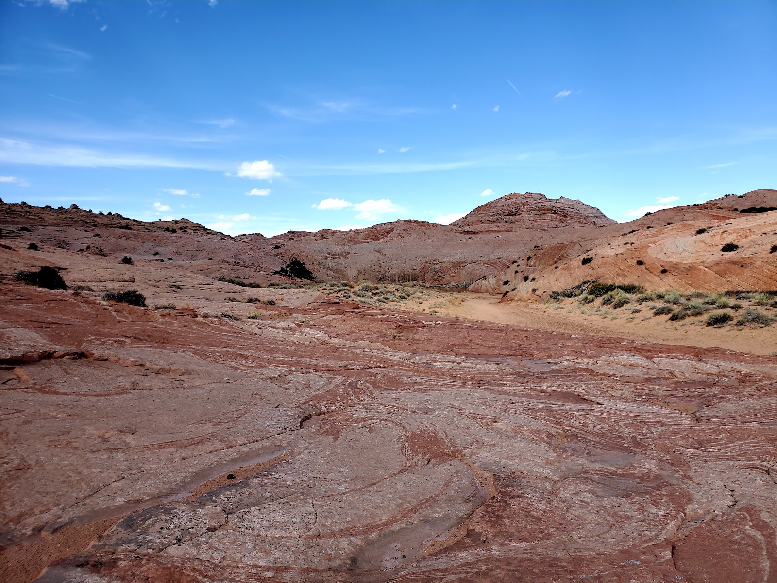
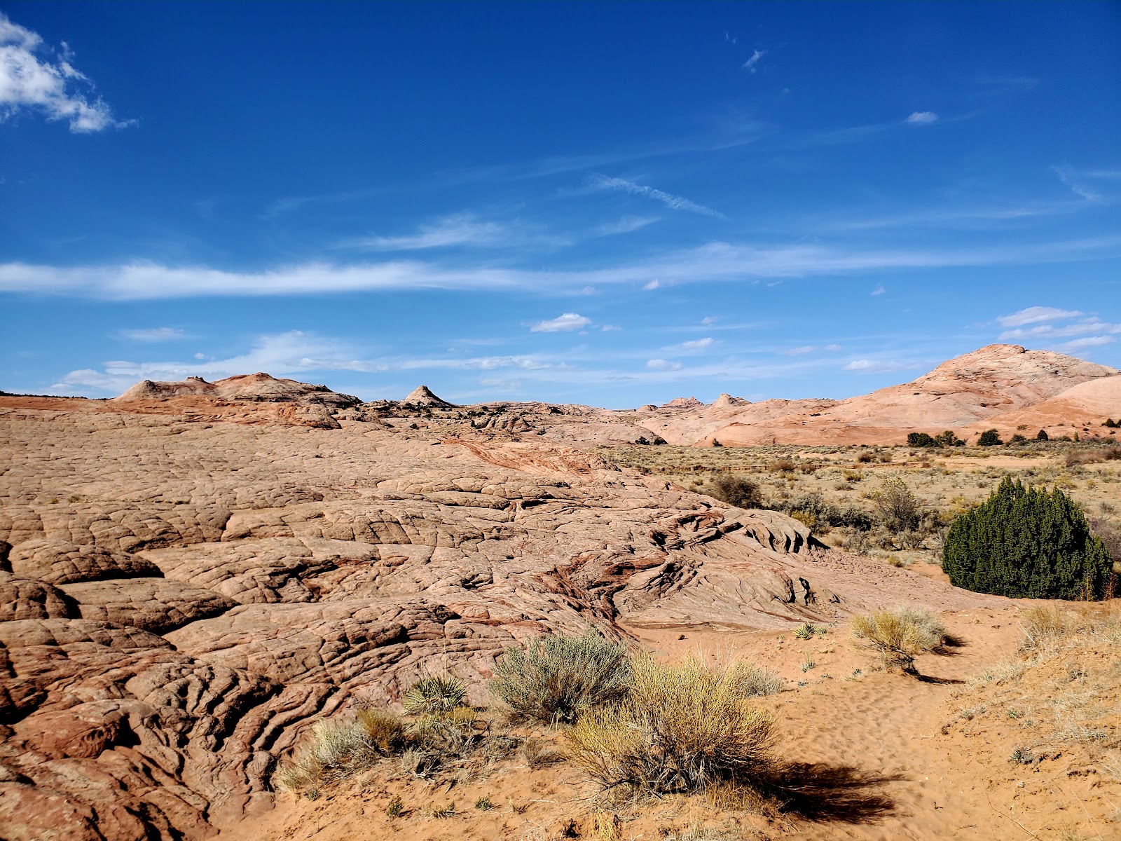
The views along the trail are amazing and the red rock with its striations
remind me a lot of the pictures I have seen of The Wave down in Arizona.
.
.
Eventually you will arrive at a huge open wash called Harris
Wash and the trail becomes a little more difficult to follow. You will see
the whiter sands of Harris Wash in front of you and it might look like you
should cross through the wash to the other side. Don’t do this. The trail on
the other side of the wash will leave you wandering around in the desert longer
than anticipated and eventually takes you to Tunnel Slot Canyon. Instead stay
to the left of the wash (you could also walk in the wash if you want, but
it might be a little more difficult because of the sand. Eventually you will have
to walk in the wash for a little ways though just don’t ever cross to the other side!)
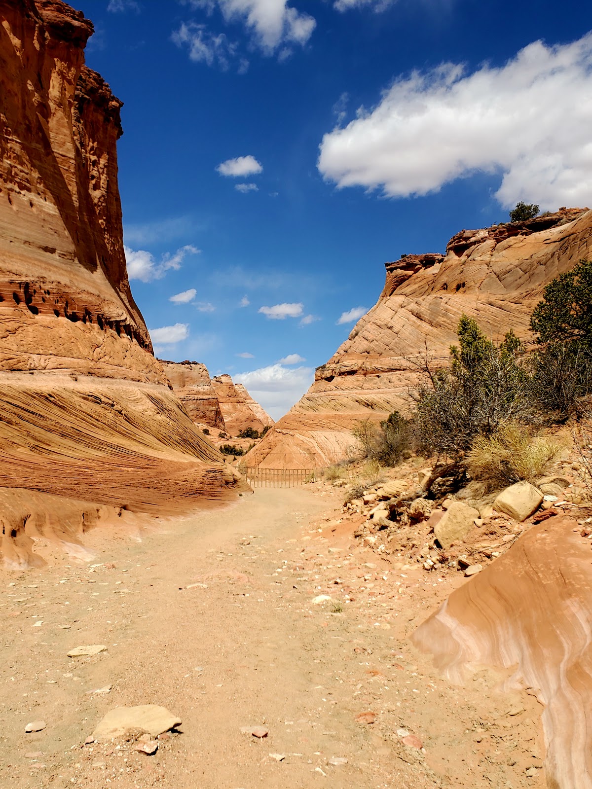
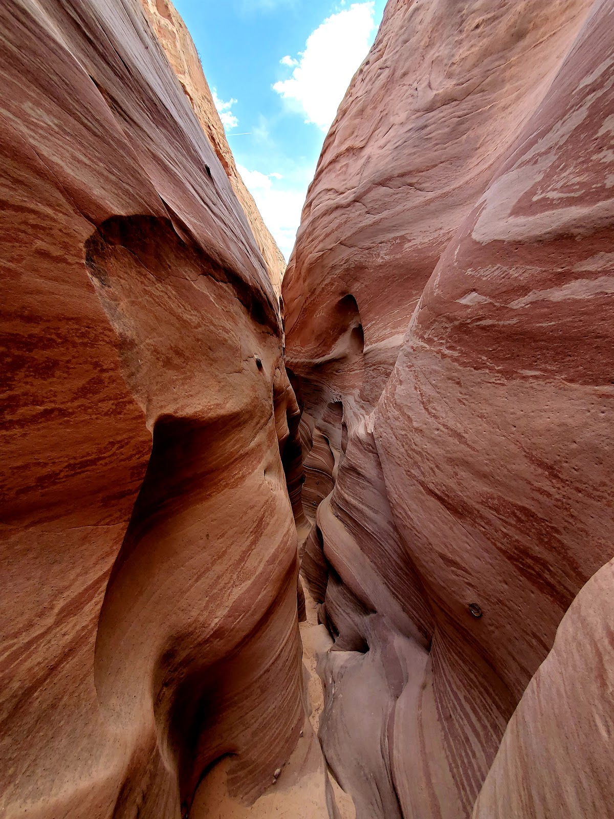
The trail ends right at the mouth of Zebra Slot Canyon. (If you want a better view of
the trail you can see it here on Google Maps.)
.
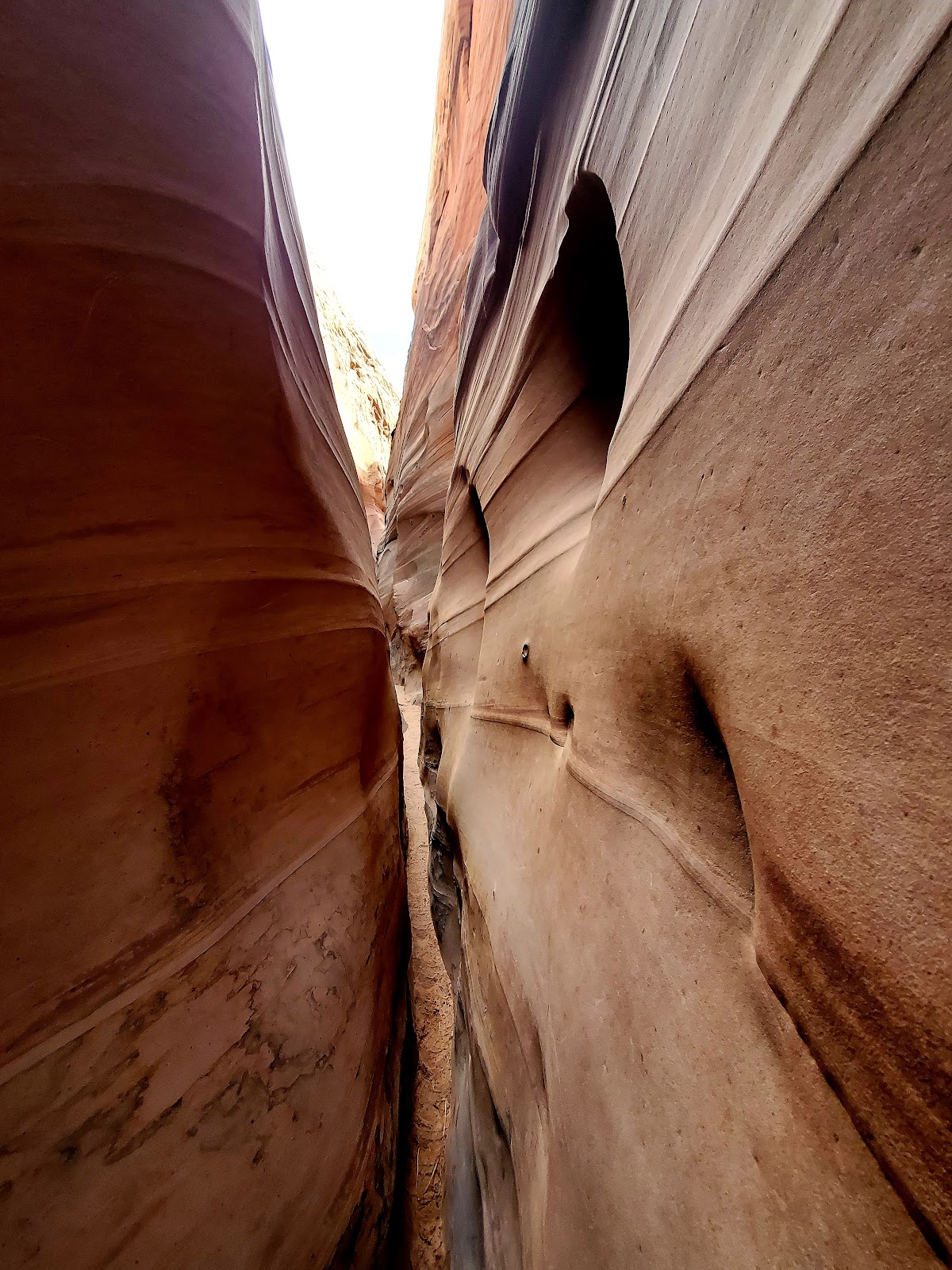
Inside of Zebra Slot
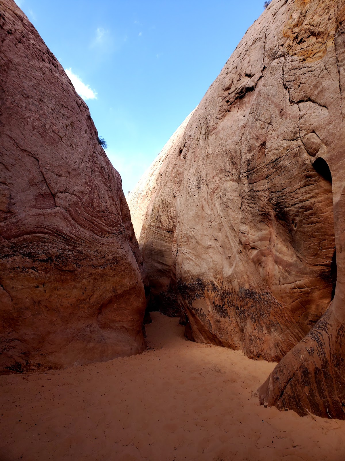
Mouth of the canyon
https://videopress.com/v/WmKPtnU5?resizeToParent=true&cover=true&preloadContent=metadata
.
Staring into the mouth of the canyon I could hear voices of other
hikers echoing off the narrow walls along with a sound I was hoping
I wouldn’t hear, the sloshing of footsteps through water. Not only was
I going to have to overcome my fear of tight spaces I was also going to
have to overcome my fear of walking in water I can’t see through. *sigh* yay adventure. Lol
.
I waited for the other hikers to emerge and sat down in the sand
to put on my chacos (highly recommend you wear some type of water
shoe and not go barefoot. Like I said you can’t see through the murky
water so protect your feet! You still have to hike back to your car after the
canyon.). While I was putting on my shoes this group of two guys came into
the canyon and started making their way through it so I hurried up and followed
along behind them. (I was nervous and not about to make my way through
there completely alone! Lol)
.
Turns out they were the best guys I could have followed behind because
not only were they super nice and helped me through the canyon, but they
were also very experienced climbers so they knew exactly what they were doing.
So shout-out to Willis & Eli the father and son team from Provo, Utah. I wouldn’t
have made it through that canyon without you!
.
Another quick tip for the canyon: it gets extremely narrow in some spots and
so I highly recommend you either don’t bring a bag or bring a small fanny pack.
I tried to lug my hiking backpack through there and it was just not a fun time. I
eventually ended up just ditching it about halfway through and prayed no one would take it. Lol
.
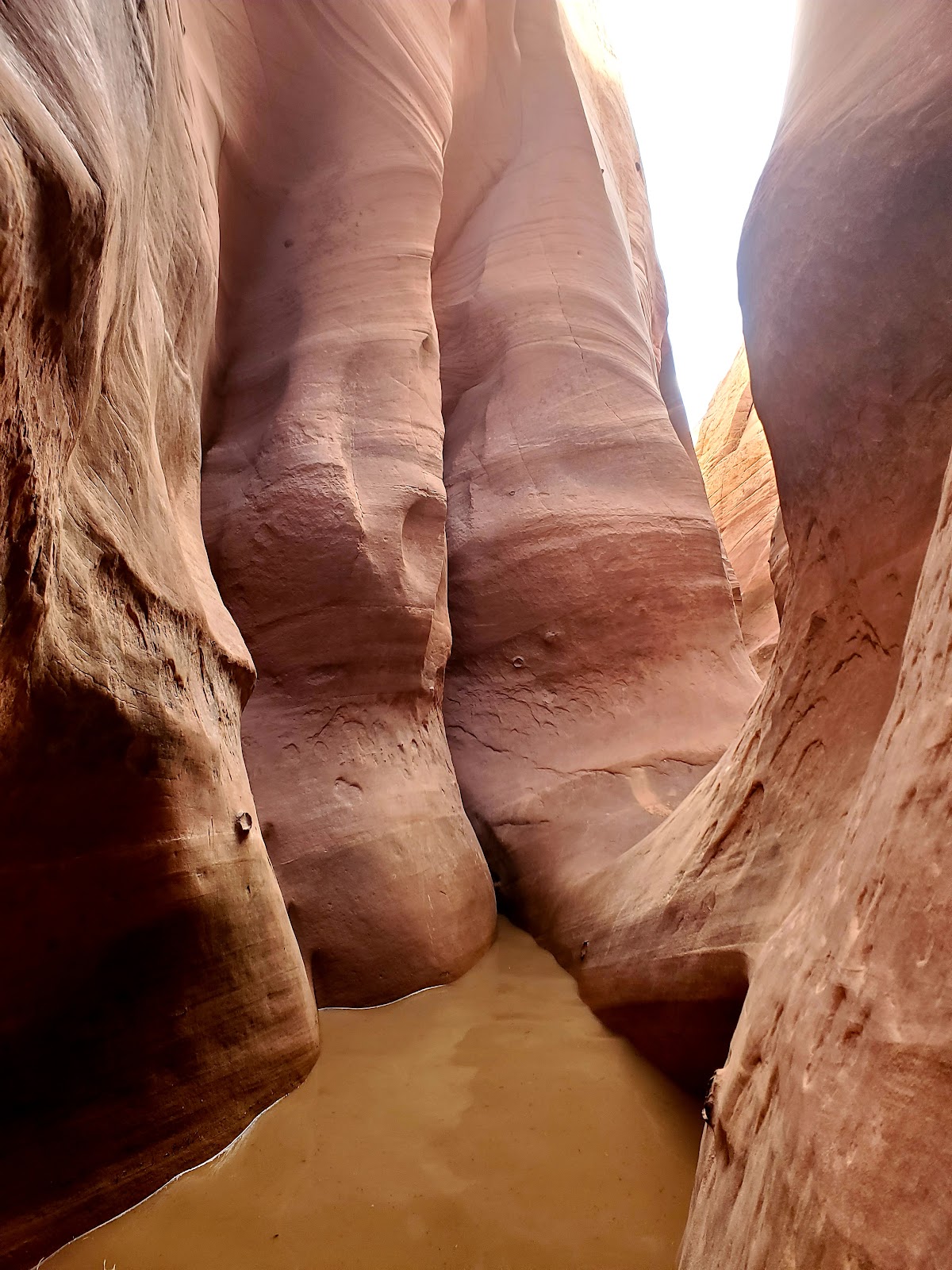
Into the smelly brown water I go…
https://videopress.com/v/6Rsy1STR?resizeToParent=true&cover=true&preloadContent=metadata
As you can see the water is almost to my knees!
.
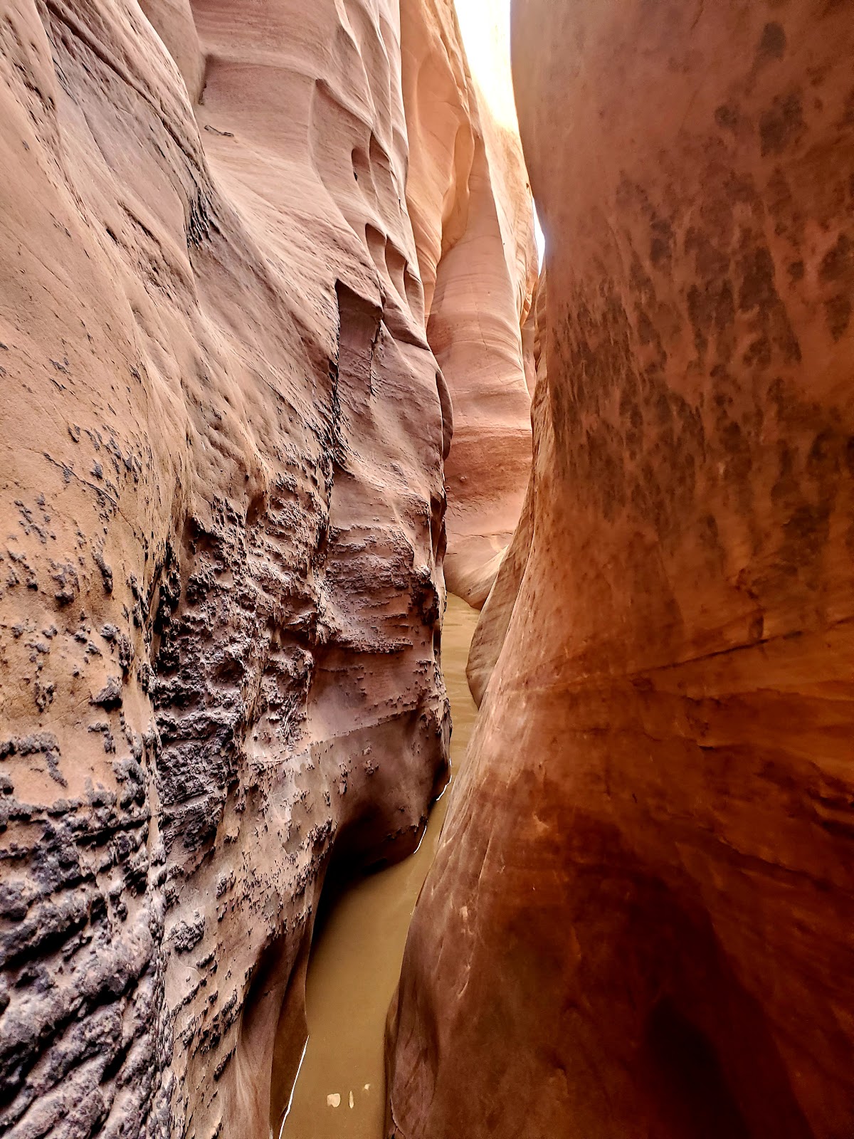
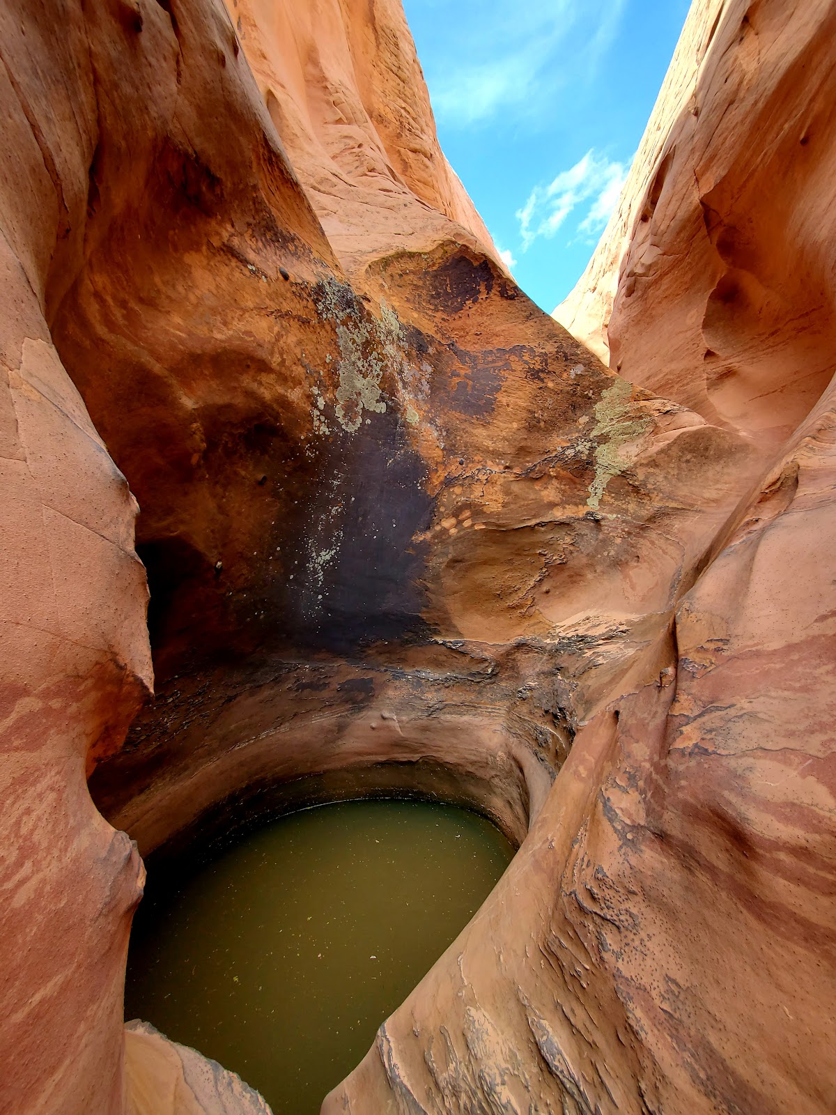
The end of the road. It was at this point in the canyon not knowing exactly how deep that pool of water was and there being a huge gap (hard to tell from the picture) from where we were standing to the other side that we called it quits and headed back the way we came.
.
.
We walked back to the trailhead together taking in the views
and conversing about our lives.
.
.
Then I made my way back to Tropic, Utah where I would be staying
one final night at the Red Ledges Inn and ate a dinner of leftover pizza from The
Pizza Place and chilled in bed.
.
.
.